Abstract: Sugar Cove is a tributary stream to the North River in the Cherokee National Forest. For most of its fishable length, Sugar Cove is 15 to 20 feet wide with many pools up to 3 feet deep. There is one major waterfall that is preceded by a bedrock slide. The combination makes for one of the most beautiful streams on the forest. Brook (northern strain) and rainbow trout are present below the falls with only brookies found above it. The hiking trail beside the stream above the bridge is in fairly good condition. Most of the trail is flat until the last half mile (well above fishable water) where it becomes very steep (several switchbacks).
Sugar Cove is a tributary stream to the North River/Tellico River/Little Tennessee River in the Cherokee National Forest (Big Junction Quad Map). Its headwaters are over 4600 feet in elevation with the highest area being along the Tellico-Robbinsville Road (State Hwy 165) between Beech and Stratton Gaps.
 The stream joins with Meadow Branch at 2300 feet to form the North River. It is fishable for about 2.6 miles to an elevation of 3400 feet. The average gradient is 4.5% but this measure is somewhat deceptive. Two waterfalls and a bedrock slide located 1.7 miles upstream of the confluence with Meadow Branch account for most of the gradient. For most of its fishable length, Sugar Cove is 15 to 20 feet wide with many pools up to 3 feet deep.
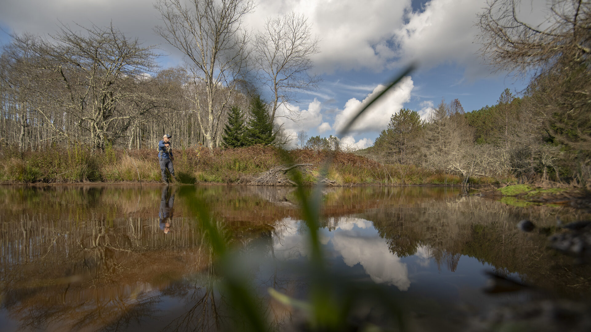
The confluence of Sugar Cove with Meadow Branch is beside the North River Road (Forest Service Road 217); however, the drop from the road to the stream is about 100 down a very steep hill. Look for an undeveloped trail or hang onto trees and shrubs as you make your way to the bottom. From the confluence with Meadow Branch to the FSR 217 bridge (approximately 1 mile), Sugar Cove is heavily overgrown with rhododendron but is fishable. Rainbow trout dominate this section but brook trout are becoming more common. Above the bridge the stream has limited fishable water for about 0.7 miles where you encounter a massive bedrock outcrop – it looks like a waterslide on very a steep slope. Walk up this “slide” to a 30 foot waterfall followed by a 12 foot falls. I think the slide and falls on this stream make it among the beautiful streams on the Forest. There is a trail on the right side of the stream (the Quad map has the trail location wrong) that will get you around the falls. Above the falls the stream flows gently beside the trail and should have only brook trout present. The stream was chemically renovated in 1990 to remove the rainbow trout.
Current regulations allow year-round fishing with flies and lures only. A three fish per day limit with size limits is imposed. If you are primarily interested in catching brook trout, park near the bridge over Sugar Cove, walk up the road about 100 yards to Forest Service Trail 89 and follow it to the first stream crossing (about 0.6 miles). You are now above the falls and in brook trout water.
Submitter: Jim Herrig
Date Submitted: 6/1/2006
Name: Sugar Cove
Location and Access: In Tellico Plains (at the junction of Hwy 68 and 165), drive east on Hwy 165 (Tellico-Robbinsville road or Cherohalla Hwy). At the east edge of town stay on Hwy 165; do not turn onto Hwy 360. Continue on Hwy 165 for about 5 miles. It parallels the Tellico River and crosses it once. Just passed the Oosterneck pulloff, take Forest Service Road (FSR) 210 toward Bald River Falls and the Ranger Station. Continue on FSR 210 for about 11 miles to North River Road (FSR 217). It parallels North River and crosses it twice. Continue on FSR 217 for about 9 miles. You will come to a bridge over Sugar Cove. Park to the left side of the stream and bridge. Walk across the bridge and follow the road for about 100 yards to Forest Service Trail 89. Hike the trail to the first stream crossing. You are now in brook trout water. Use the trail to take you back to your vehicle.
Fish Species: brook and rainbow trout
Regulations: Single hook, artificial only.