Abstract: The North Fork of Citico Creek is a tributary stream to Citico Creek in the Citico Creek Wilderness Area of the Cherokee National Forest (Whiteoak Flats Quad Map). It is easy to access from the lower end with a trail paralleling it. Rainbow trout are abundant and easy to catch. The difficult stretches, where brook trout are present, are extremely remote (about six miles one way). The brook trout water is difficult to fish and the number of brook trout present may be minimal.
The North Fork of Citico Creek combines with the South Fork to form Citico Creek which flows to the Little Tennessee River in the Cherokee National Forest (Whiteoak Flats Quad Map). It meanders beside an old railroad grade that serves as the access trail from the confluence with the South Fork and is entirely within the Citico Creek Wilderness where its headwaters (Bob Bald) are over 5000 feet in elevation. The brook trout waters on this stream are remote; occurring, according to Jim Habera with TWRA, above Goat Falls at about the 3200 foot contour.
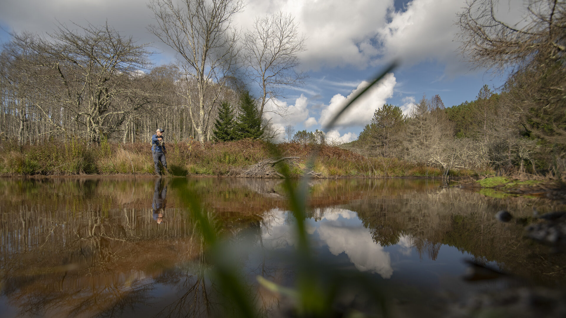
 The stream combines with the South Fork of Citico Creek at about 1760 feet. From its confluence with South Fork of Citico Creek upstream for about five miles, the North Fork is a low gradient (four to five percent) stream. Above this stretch, the stream enters a steep gorge with an average gradient of 15%. Rhododendron stretches it branches across the entire stream. Goat Falls is the only named waterfall; it is only about 30 high. The numerous smaller falls and thick rhododendron make travel up the stream difficult. The trail, which has changed from an old railroad grade to a hand-dug path, is no better for traveling. Above the gorge, the stream flattens out and the trail follows the stream very closely, sometimes in it. The rhododendron is very dense and fishing becomes ever more difficult. The brook trout water extends up to about the 3600 foot contour (only about 1/3 mile).
From the bottom it is about 6 miles into where the brook trout are; and from Beech Gap on the Cherahala Skyway (State Highway 165), it is about 7.5 miles to the brook trout water. I recently (October, 2006) fished from the bottom up to the brook trout water. Along the way I landed over 60 rainbow trout but when I reached the gorge, I could not catch another fish and did not see any above Goat Falls.
The North Fork of Citico Creek is a great fishing stream. There are plenty of small trout and the stream is wide and open, making casting easy. The trail, beside the stream on the lower end, is in good condition and is easy to follow. There is plenty of pocket water and some big long pools; but deep pools are lacking. In the gorge area, the pools get deeper and are difficult to traverse because you are hemmed in by the rhododendron on both sides of the stream. Above the gorge the gradient flattens eventually becoming very shallow and incapable of supporting trout. If you want to catch brook trout, this is the last stream in the Tellico area that I would fish; but if you want to have some easy rainbow trout fishing and a nice hike, stay on the lower end. As a bonus, brown trout are present in the very lowest stretch. A fishing buddy once landed a 15 inch brown near the TVA gauging station.
Current regulations allow year-round fishing with no special gear restrictions. Seven fish per day may be taken; brook trout must be at least six inches.
Submitter: Jim Herrig
Date Submitted: 10/16/2006
Name: North Fork of Citico Creek
Location and Access: In Tellico Plains (at the junction of Hwy 68 and 165), drive east on Hwy 165 (Tellico-Robbinsville road/Cherohalla Hwy). At the east edge of town stay on Hwy 165; do not turn onto Hwy 360. Continue on Hwy 165 for about 15 miles to the Indian Boundary Lake turnoff (Forest Service Road 345). At the Indian Boundary Lake entrance, turn onto FSR 35-1 toward Citico Creek. When this road reaches Citico Creek, turn right and cross a low water bridge into Warden Fields and park here. Follow trail 105 across Citico Creek to trail 98 (about 0.5 miles). Turn left onto trail 98 and cross the high bridge over the South Fork of Citico Creek. The trail follows the North Fork the rest of the way. You can also access the North Fork from Beech Gap off the Cherahala Skyway (about 8 more miles on 165 beyond the Indian Boundary Lake turnoff) but this route is longer and offers no fishing opportunities along the way.
Fish Species: brook trout throughout, rainbow trout in the lowest reach
Regulations: Seven trout per day; brook trout must be at least six inches.