Abstract: Falls Branch is a tributary stream to Citico Creek in the Citico Creek Wilderness Area of the Cherokee National Forest (Whiteoak Flats and Big Junction Quad Map). It has stretches that are difficult to access but also an area that is easily accessed. The difficult stretches do not have a trail associated with them. Brook trout are present in the entire stream but rainbow trout dominate in the lower stretches. Falls Branch is a beautiful stream with a spectacular waterfall and many large, old growth trees.
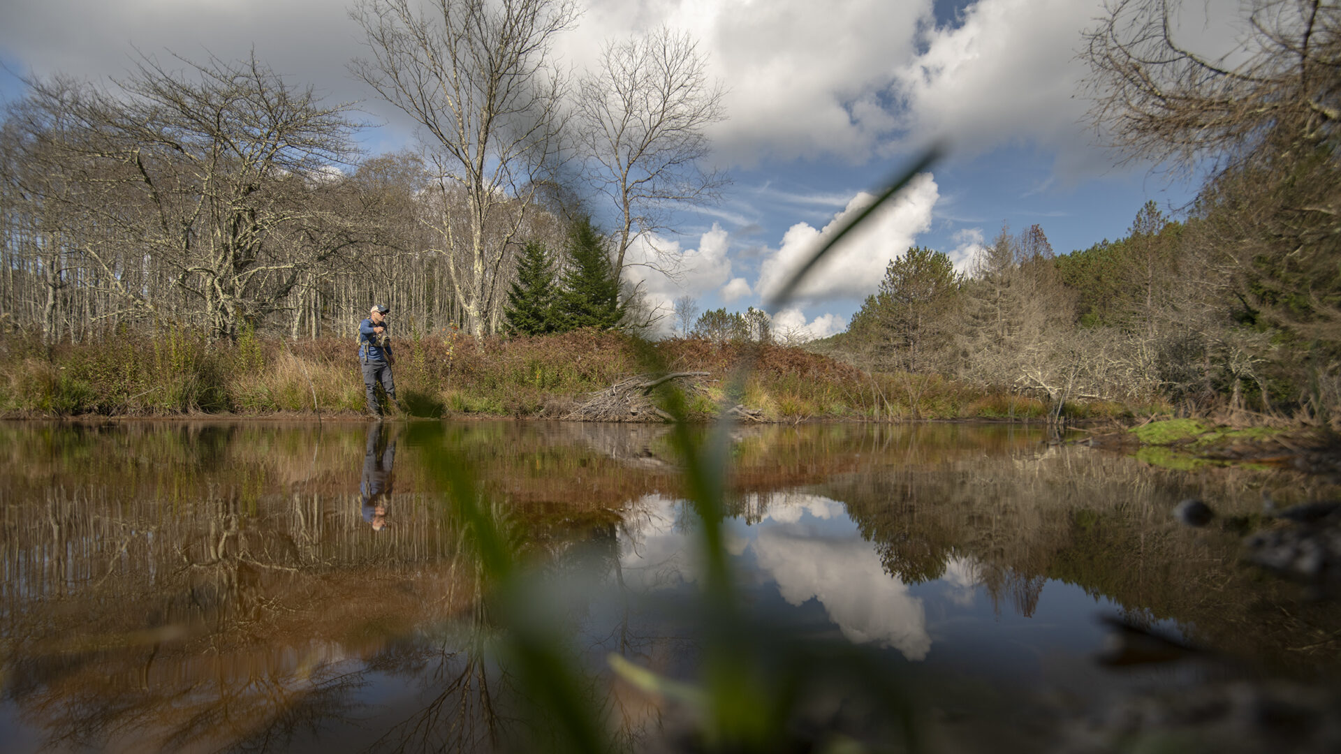
Falls Branch is a tributary stream to South Fork of Citico Creek/Citico Creek/Little Tennessee River in the Cherokee National Forest (Whiteoak Flats and Big Junction Quad Maps). It flows through the only virgin (never harvested) timber stand known on this Forest and has a beautiful namesake waterfall. Falls Branch is entirely within the Citico Creek Wilderness where its headwaters (Bob Bald) are over 5000 feet in elevation. This stream is both remote and easily accessed. A two mile trail from Rattlesnake Rock Observation Site leads to the falls but access upstream or downstream is extremely difficult.
The stream combines with the South Fork of Citico Creek at about 2880 feet. From its confluence with South Fork of Citico Creek upstream for about one and a quarter miles (no trail), Falls Branch is a series of low (usually less than 12 feet high), bedrock waterfalls. Above this stretch, the stream flattens out and continues to be difficult to climb because of the large quantities of down timber. Some logs are over 3 feet in diameter! After about a  half mile you will reach the trail leading to the 40 falls that is in a deep gorge. The reason this area was never harvested becomes obvious. There was no easy way to get into it from above or from below with a railroad line. Above the falls (a very dangerous climb) Falls Branch enters Jeffery Hell. The rhododendron is so thick for the next mile and a quarter that you will be crawling more than walking and the fishing will be difficult. If you continue through Jeffrey Hell, you will eventually come to trail 196 which will lead you back to Rattlesnake Rock Observation Site. This area is called Jeffrey Hell after a fellow who wandered in there and never came out. There is no good reason for going in!
The first 1.75 miles of Falls Branch is fishable with the better water occurring with the small waterfalls in the lowest reach. Both rainbow and brook trout are present from the confluence up to the big waterfalls. The average gradient is 10% below the falls with channel widths of 10 to 15 feet except at the falls where it is quite wide. Some pools are up to 4 feet deep. Above the falls, the stream is split into multiple channels that are so densely covered in rhododendron that you either walk on top of it or crawl through it. Gradient averages 5%. Only brook trout (northern strain) are present above the falls.
Falls Branch is close to the Cherohala Skyway (State Highway 165) with a trail (Forest Service trail 87) leading from Rattlesnake Rock Observation Site to the waterfalls (approximately 2 miles). Most of the trail is an old road bed and is easy to walk. The last half mile is a steep trail that winds through some beautiful old growth trees before crossing Falls Branch and climbing to base of the falls. There is no trail upstream or downstream of the falls. To access the lower stretch, follow Forest Service Trail 196 from Rattlesnake Rock Observation Site (for about 3 miles) to Forest Service Trail 105 which parallels the South Fork of Citico Creek. Continue down this trail about 2 miles and cut down the hillside to the confluence. If you are going to do this route, plan for a full day (12 hours plus) of hiking and climbing. Access to Falls Branch above the falls is best (if there is any good way) from where trail 196 crosses it; but you will immediately be struggling through the rhododendron. Current regulations allow year-round fishing with no special gear restrictions. Seven fish per day may be taken; brook trout must be at least six inches.
Submitter: Jim Herrig
Date Submitted: 10/6/2006
Name: Falls Branch
Location and Access: In Tellico Plains (at the junction of Hwy 68 and 165), drive east on Hwy 165 (Tellico-Robbinsville road or Cherohala Hwy). At the east edge of town stay on Hwy 165; do not turn onto Hwy 360. Continue on Hwy 165 for about 23 miles to Rattlesnake Rock Observation Site. Take Forest Service Trail 87 (2 miles) to the falls; trail 196 to upper Falls Branch (approximately 0.75 miles) or continue on 196 (approximately 2.25 miles) to trail 105; travel about 2 miles down 105 then go cross country to Falls Branch confluence with the South Fork of Citico Creek.
Fish Species: brook trout throughout, rainbow trout in the lowest reach
Regulations: Seven trout per day; brook trout must be at least six inches.