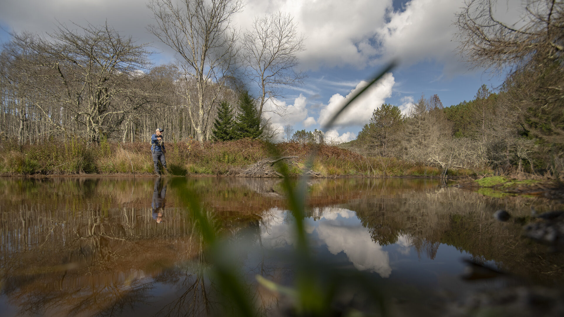
Abstract: Bald River is a tributary stream to the Tellico River in the Cherokee National Forest (Bald River Falls and Big Junction Quad Maps). It is easy to access from Forest Service trail 88 through Bald River Gorge Wilderness or along Forest Service Road 126 south of the Wilderness or by hiking up Forest Service Trails 180 and 2. Above the Brookshire Creek confluence, you will be in a large cove with the trail gradually climbing the valley wall and leaving the stream. The stream has only southern strain brook trout.
There are about 2.5 miles of fishable water with no steep, cascades or waterfalls. Plan to camp or leave yourself plenty of time to get out. It’s a long hike but the trail is not steep or rough. Bald River is a tributary to the Tellico River/Little Tennessee River in the Cherokee National Forest (Bald River Falls and Big Junction Quad Maps). Its headwaters are over 4200 feet in elevation with the highest area being on Beaverdam Bald (4259 feet). Access to this stream is variable depending on where you want to go. At its confluence with Tellico River, Bald River is has a large and well known waterfall. A hiking trail follows the river above the falls through the Bald River Gorge Wilderness where the river is wide and flat. An occasional waterfall requires climbing but more flat, open water lies above. Two people can fish the entire Wilderness portion (3.7 miles) in a single long day by parking a car at the top end and driving around to the falls. Rainbow trout will dominate your catch. I have never caught brown or brook trout in this reach.
Above the Wilderness, Forest Service Road 126 parallels the river for about 1.3 miles to Henderson Branch. This stretch of river is very flat and open. Casting is easy and it is a great place to teach someone to trout fish. Rainbow trout are dominant but brown trout are not uncommon and an occasional brook trout is present. Above Henderson Branch, Bald River gets a little smaller in size and access is limited to Forest Service trail (180). Horses are allowed on this trail. These two miles of river contain the same mix of species as below except the brook trout become more abundant. This stretch is an excellent area to try to catch all three species of trout in one day.
At the confluence with Brookshire Creek, the trail continues up Bald River for about for about 1.5 miles where it crosses the stream and leaves the valley. The gradient increases and the river gets smaller. I have not seen any significant waterfalls in this stretch. The valley is wide with the trail high above it. Only brook trout are present; the southern strain of brook trout. Fishable water continues above the trail crossing for about a mile.
Access Bald River from the Tellico River Road (Forest Service Road 210). Park at the falls and hike up the trail into Bald River Gorge Wilderness. Another good trip for one or two people is to park at the bridge on FSR 126 and hike down into the Wilderness. Access between the bridge and Henderson Branch confluence is excellent because FSR 126 follows the stream very closely. Finally, to access the upper reaches, park at Henderson Branch and hike Forest Trail 180. It is two miles to the Brookshire Creek confluence with one ford. Current regulations allow year-round fishing with flies and lures only. A three fish per day limit with size limits is imposed.
Submitter: Jim Herrig
Date Submitted: 2/21/2007
Name: Bald River
Location and Access: In Tellico Plains (at the junction of Hwy 68 and 165), drive east on Hwy 165 (Tellico-Robbinsville road or Cherohalla Hwy). At the east edge of town stay on Hwy 165; do not turn onto Hwy 360. Continue on Hwy 165 for about 5 miles. It parallels the Tellico River and crosses it once. Just passed the Oosterneck pulloff, take Forest Service Road (FSR) 210 toward Bald River Falls and the Ranger Station. Continue on FSR 210 for about 9 miles to Bald River Falls. Hike the trail (FST 88) into the Wilderness. Or after turning off Hwy 165 go about one half mile to a bridge that crosses the Tellico River. This is Wildcat Road (FSR 384); follow it to the junction with FSR 126 (about 6.5 miles but seems a lot longer). Follow FSR 126 for about 5 miles to the bridge over Bald River. FST 88 has a trailhead here. The Henderson Branch confluence is about 1.5 miles further down this road. You will pass Holly Flats Campground which is also on this road. Fish the river along the road or take the hiking/horseback riding trail (FS 180) which parallels Bald River upstream for two miles to the confluence with Brookshire Creek. A trail continues up Bald River for about 1.5 miles.
Fish Species: Rainbow, brown and brook trout
Regulations: Single hook, artificials only; 3 fish per day; 6 inch size limit for brook trout.